LACKAWANNA STATE PARK
The 1,445-acre Lackawanna State Park is in northeastern Pennsylvania, ten miles north of Scranton.
The centerpiece of the park, the 198-acre Lackawanna Lake, is surrounded by picnic areas and multi-use trails winding through forest. Boating, camping, fishing, mountain biking, and swimming are popular recreation activities.
Hotels/Motels
Located near popular recreational attractions, including the Claws 'N' Paws Wild Animal Park, Steamtown National Historic Site and Promised Land State Park. NASCAR fans will enjoy a day at the races at nearby Pocono Raceway.
19.9 miles from park*
The pool -- with a spray ground/splash zone and zero-entry points for people with disabilities -- is open seasonally.
The Lackawanna State Park Swimming pool is open from 1100 A.M. to 700 P.M., starting Memorial Day weekend.
It is usually open weekends until mid-June, then open every day through mid-August, and then open weekends until Labor Day. For exact dates, please contact the park office at 570-945-3239.
electric motors only
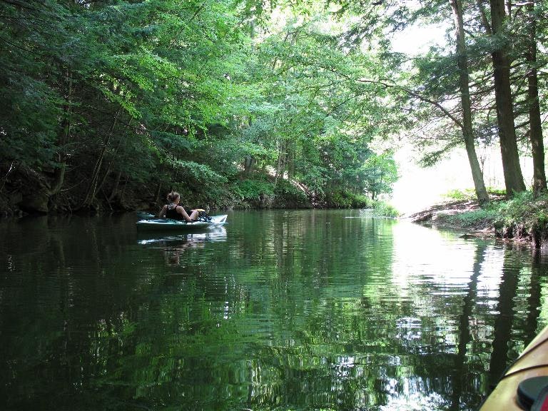
The 198-acre Lackawanna Lake is popular for canoeing, kayaking, and rowing. There are three boat launches around the lake. A limited number of boat mooring spaces are available on a seasonal basis.
The 198-acre Lackawanna Lake has cold water and warm water fish. The 2.5-mile-long lake has more than 7.5 miles of shoreline.
Common species are Trout Muskellunge Walleye Channel catfish Bullhead Pickerel Largemouth bass
Lackawanna State Park is located near Carbondale, Clarks Summit and Dallas
Most of the main picnic area overlooks the lake. Grills and modern restrooms are throughout the area.
Small picnic areas can be found at the Bullhead Bay Boat Launch to the north, and States Creek Mooring Area on the southern end of the lake.
Three picnic pavilions may be reserved up to 11 months in advance for a fee. If not reserved, the pavilions are free on a first-come, first-served basis.
18 miles of trails
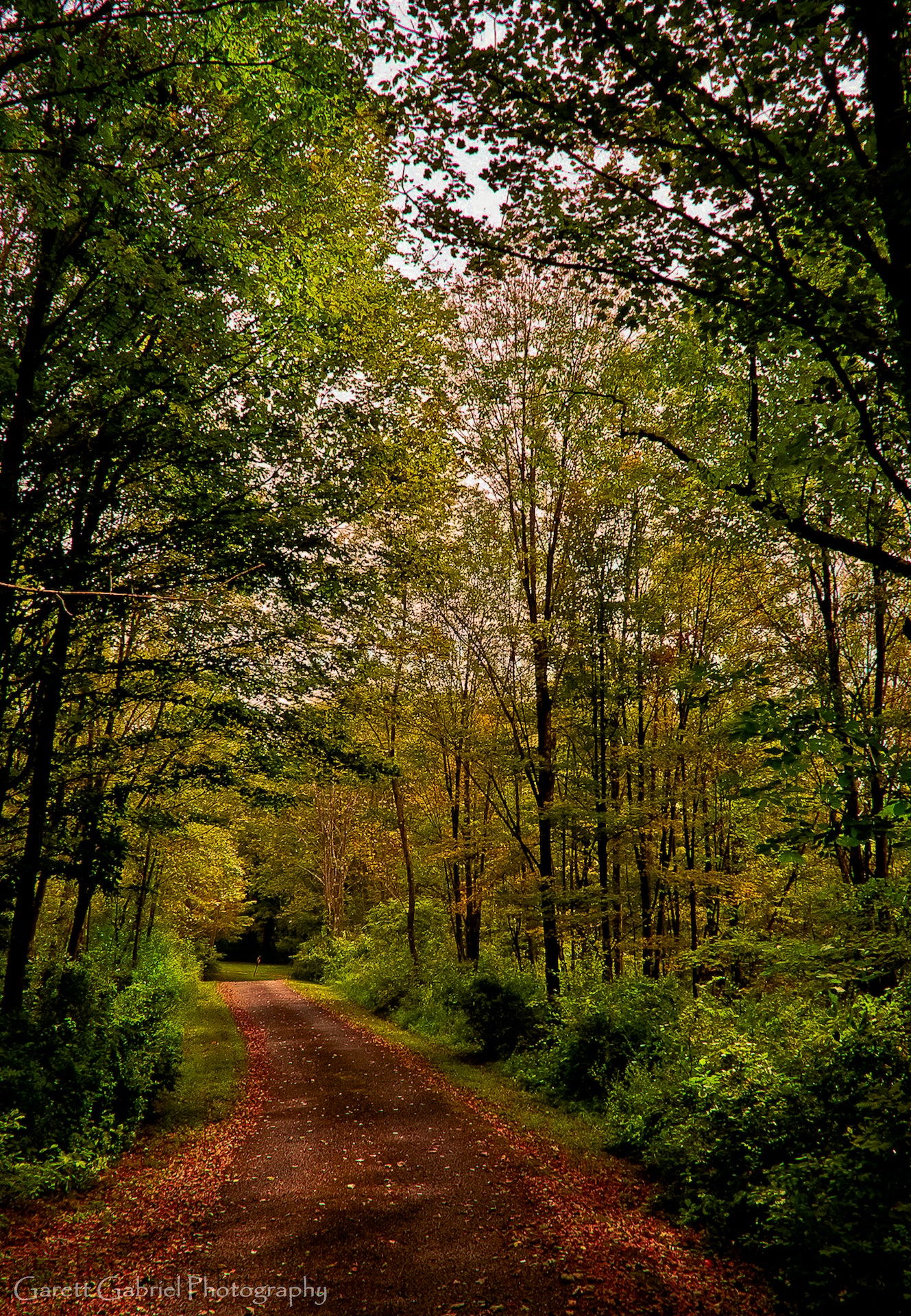
A series of looping trails limited to foot traffic wander through the campground and day use areas of the park. Additional multi-use trails explore forests, fields, lakeshore areas, and woodland streams.
Abington Trail
2.0 miles
Bassett Path
0.75 mile
Bear Paw Trail
0.5 mile
Beechwoods Trail
1.1 miles
Bull Hill Trail
1.0 mile
Frost Hollow Trail
2.0 miles Easiest hiking Out-and-back trail Blue blazes
Grouse Trail
1.1 miles Easiest hiking Connector trail Red blazes
Joey's Trail
0.2 mile Easiest hiking Connector trail Green blazes
Joey's Trail offers an alternate route to Turkey Hill Trail.
Kennedy Creek Trail
1.0 mile More difficult hiking Connector trail Yellow blazes
Kennedy Creek Trail may be accessed from Rowlands Road parking lot. This trail offers access to Lee Hill, Lakeshore and Bassett trails.
Lakeshore Trail
1.5 miles Easiest hiking Out-and-back trail Green blazes
Lakeshore Trail starts at the trailhead locate along Route 438. This family-friendly trail offers the best views of the lake. The trail connects to Lee Hill, Kennedy Creek or Ranger trails.
Lee Hill Trail
1.5 miles More difficult hiking Loop trail Blue blazes
Lee Hill loop may be accessed from Lakeshore or Kennedy Creek Trails. This trail offers a modest change in elevation as it circles across the top of Lee Hill.
North Woods Trail
2.1 miles More difficult hiking Out-and-back trail Orange blazes
North Woods Trail starts at the dam and works its way steadily uphill, crossing routes 438 and 407 before ending at Trostle Pond. This trail passes through Eastern Hemlock groves near the dam and hardwood forest as it gains elevation.
Orchard Trail
1.0 mile Easiest hiking Out-and-back trail Yellow blazes
Orchard Trail begins opposite the parks main entrance and travels north along the lake ending near Bull Hill and Bullhead Bay. This segment of trail offers some of the best views of the lake.
Ranger Trail
1.0 mile More difficult hiking Connector trail Yellow blazes
Ranger trail begins at Route 524 and travels along the Kennedy Creek inlet. This trail crosses Route 524 again and continues on to Turkey Hill Trail.
Snowflake Trail
0.5 mile Easiest hiking Out-and-back trail Blue blazes
Snowflake Trail starts and ends along Frost Hollow Trail, offering an alternative route that runs closer to lake edge. Frost Hollow and Snowflakes Trails can be combined into a loop to return back to the trailhead.
South Branch Trail
1.5 miles Easiest hiking Out-and-back trail Red blazes
South Branch Trail travels through a field as it follows the South Branch Tunkhannock Creek. The trail eventually leaves park property and continues on to Messimer Preserve. This family-friendly hike is ideal for viewing aquatic wildlife.
Spruce Trail
1.2 miles Easiest hiking Loop trail No blazes
Spruce loop is located behind the campground contact station. As the name suggests, this modest path loops through spruce trees, as well Eastern Hemlock stands that offer cooler temperatures in the summer.
Tree Line Trail
1.0 mile More difficult hiking Loop trail No blazes
Tunnel Trail
0.01 mile Easiest hiking Connector trail No blazes
This connector trail runs under the road from the park office parking area to Turkey Hill Trail.
Turkey Hill Trail
1.0 mile Easiest hiking Loop trail Blue blazes
Turkey Hill Trail is a family-friendly trail suitable for beginner mountain bikers. This trail offers subtle inclines and open space to maneuver. This loop offers access to other trails within the Turkey Hill area.
Woodland Ponds Trail
0.75 mile Easiest hiking Loop trail Yellow blazes
The park offers a variety of birding options, with over 100 species spotted annually. It features diverse habitats such as wetlands and forests that attract different types of birds. Birdwatchers can spot warblers, woodpeckers, hawks among others during various seasons throughout the year.
A & G Outfitters
1152 Commerce Blvd
Dickson City, PA
(570) 489-1650
Billy's Bait & Tackle
Route 307 N
Lake Winola, PA
(570) 378-3001
Anglers Vice Fly Fishing
104 S State St
Clarks Summit, PA
(570) 587-2737
The park is easily reached from I-81. Visitors should take Exit 199 and travel three miles west on PA 524.
Visitors coming via U.S. routes 6 and 11 should take PA 107 east about three miles to PA 407, then south.


 Share Your Lackawanna State Park Photos (click here)
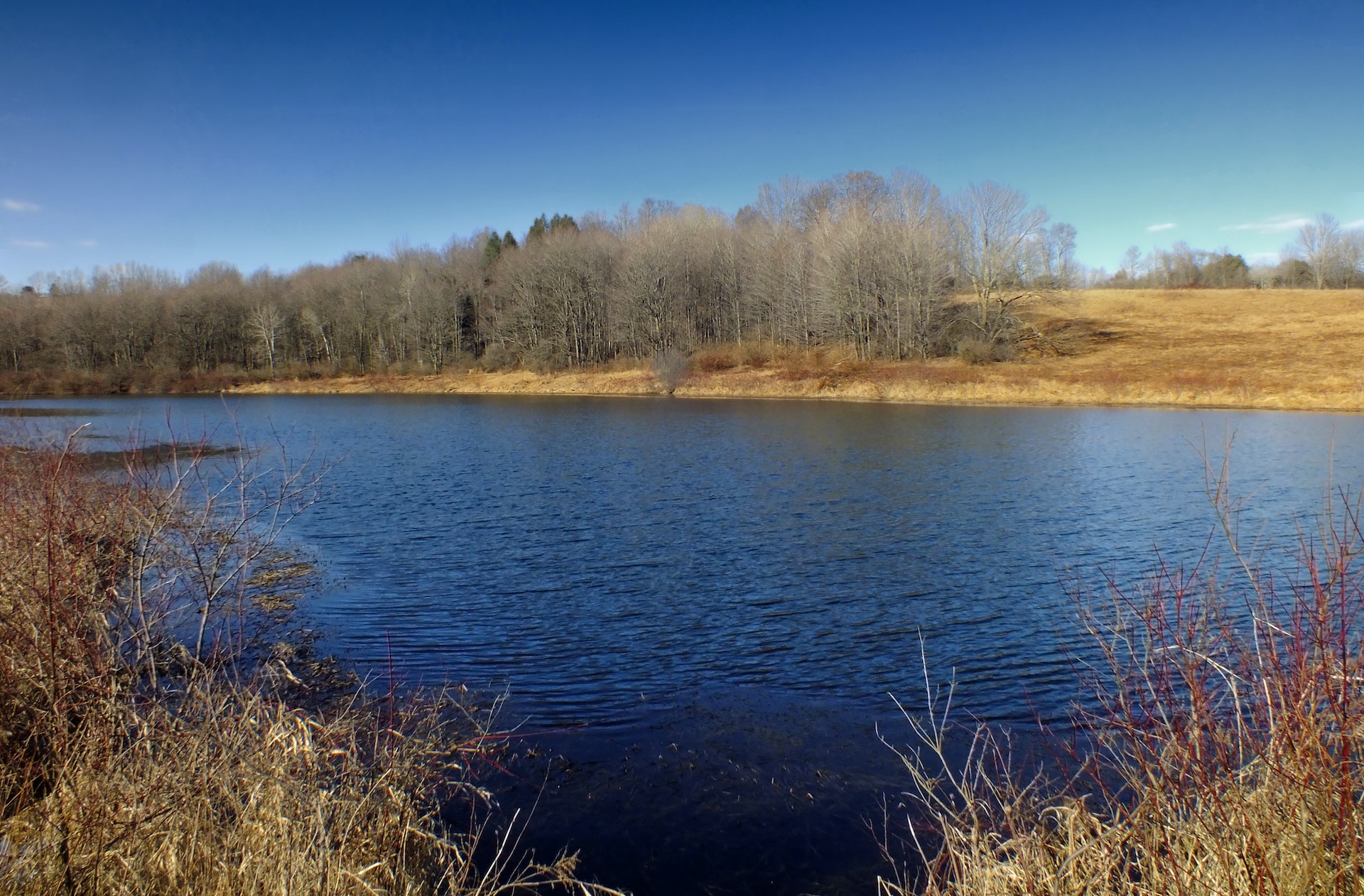