NAVAJO STATE PARK
Navajo State Park is Colorado's Answer to Lake Powell. Navajo Reservoir Extends for 20 miles South into New Mexico.
Boaters and campers enjoy the park year-round. Sailors, house boaters and other power boaters cruise some of the 15,000 surface-acres of the giant reservoir. Daily and seasonal slip and mooring ball rentals, boat rentals and gasoline for boats are available at the parks Two Rivers Marina.
Fishing enthusiasts catch crappie, large-mouth and small-mouth bass, northern pike, trout, bluegill and catfish in the reservoir.
Navajo Reservoir provides the principal storage for the Navajo Indian Irrigation Project which sends water to 110,000 acres of agricultural land on the Navajo Reservation.
The reservoir's surface totals 15,600 acres, with about 3,000 acres on the Colorado side. The system supplies water for agriculture, industrial, municipal and recreational uses.
The area where Navajo State Park now sits was originally inhabited by the Ancient Puebloans who abandoned the area around 1050 A.D. because of a serious drought at that time. The Ute and Navajo tribes settled the area during the 14th century.
The 10 explorers of the Dominguez-Escalante Expedition were some of the first white men entering the area. Their mission was to create a route from New Mexico to California for the Spaniards. In the early 1880s, the Denver and Rio Grande Western Railroad laid their tracks in the area. The railroad served the area until 1967 and was an important part of the economy.
The park facilities opened in 1964, two years after completion of Navajo dam in New Mexico by the federal Bureau of Reclamation. The dam, built on the San Juan River, backed the water up 35 miles into Colorado.
The dam was constructed as part of the Colorado River Storage Project.
All Colorado State Parks have entrance fees. All vehicles are required to have an entrance pass and some parks have walk-in fees. Visit the
Colorado Park Entrance Pass web page.
Navajo's developed campgrounds have 118 campsites, camper services buildings with showers and flush toilets, and two cabins.


 Share Your Navajo State Park Photos (click here)
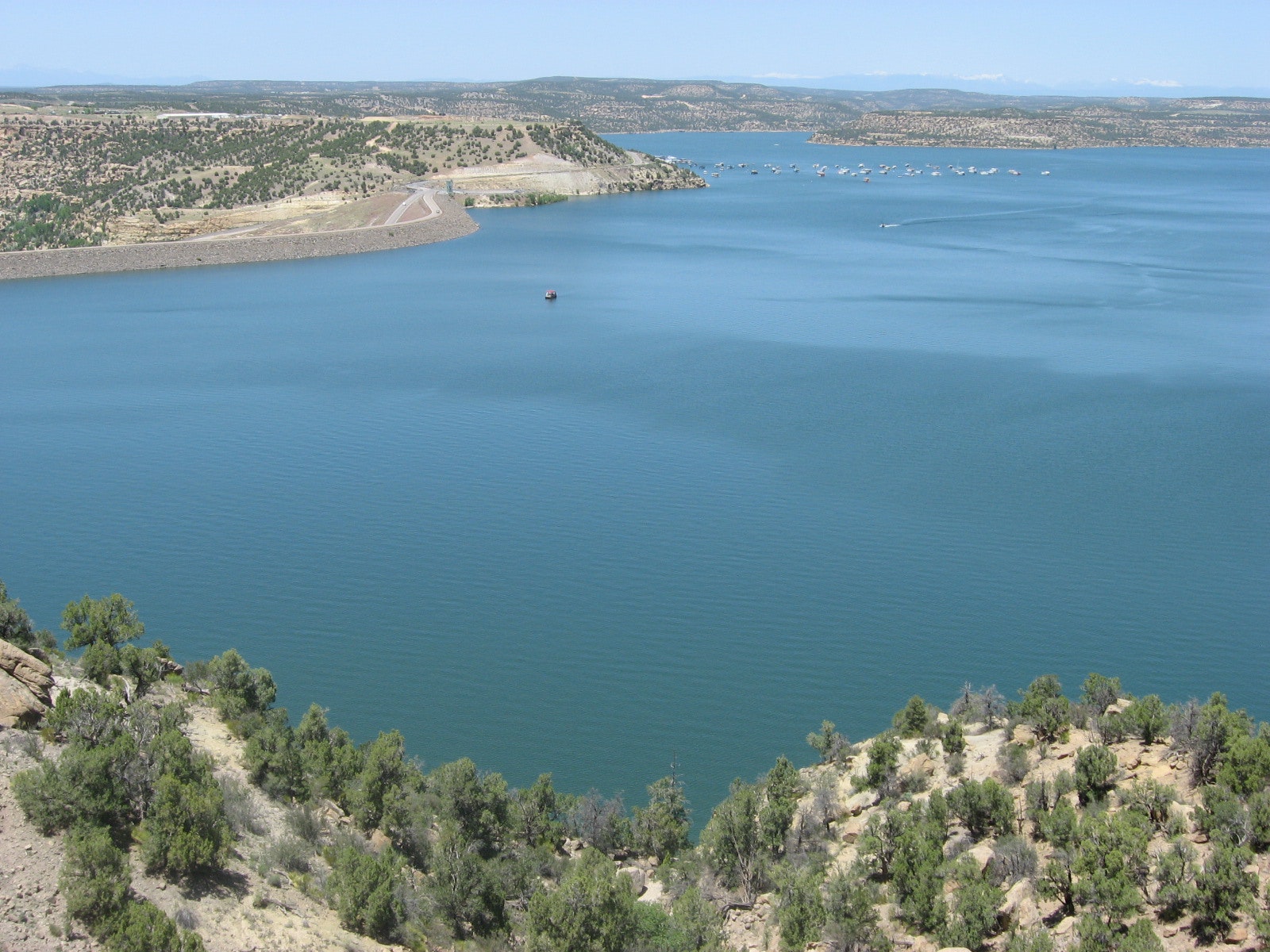