FORT CASEY STATE PARK
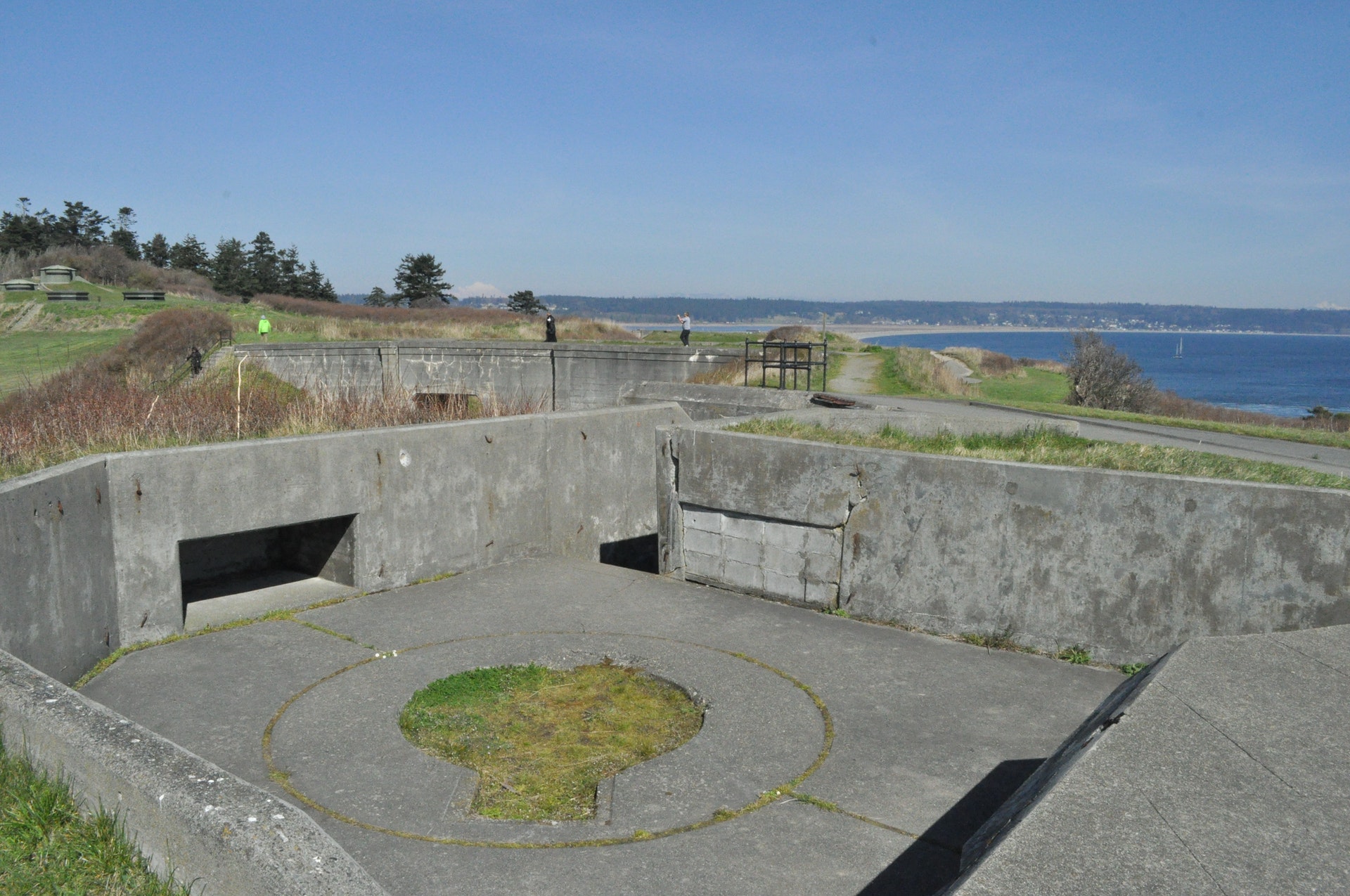
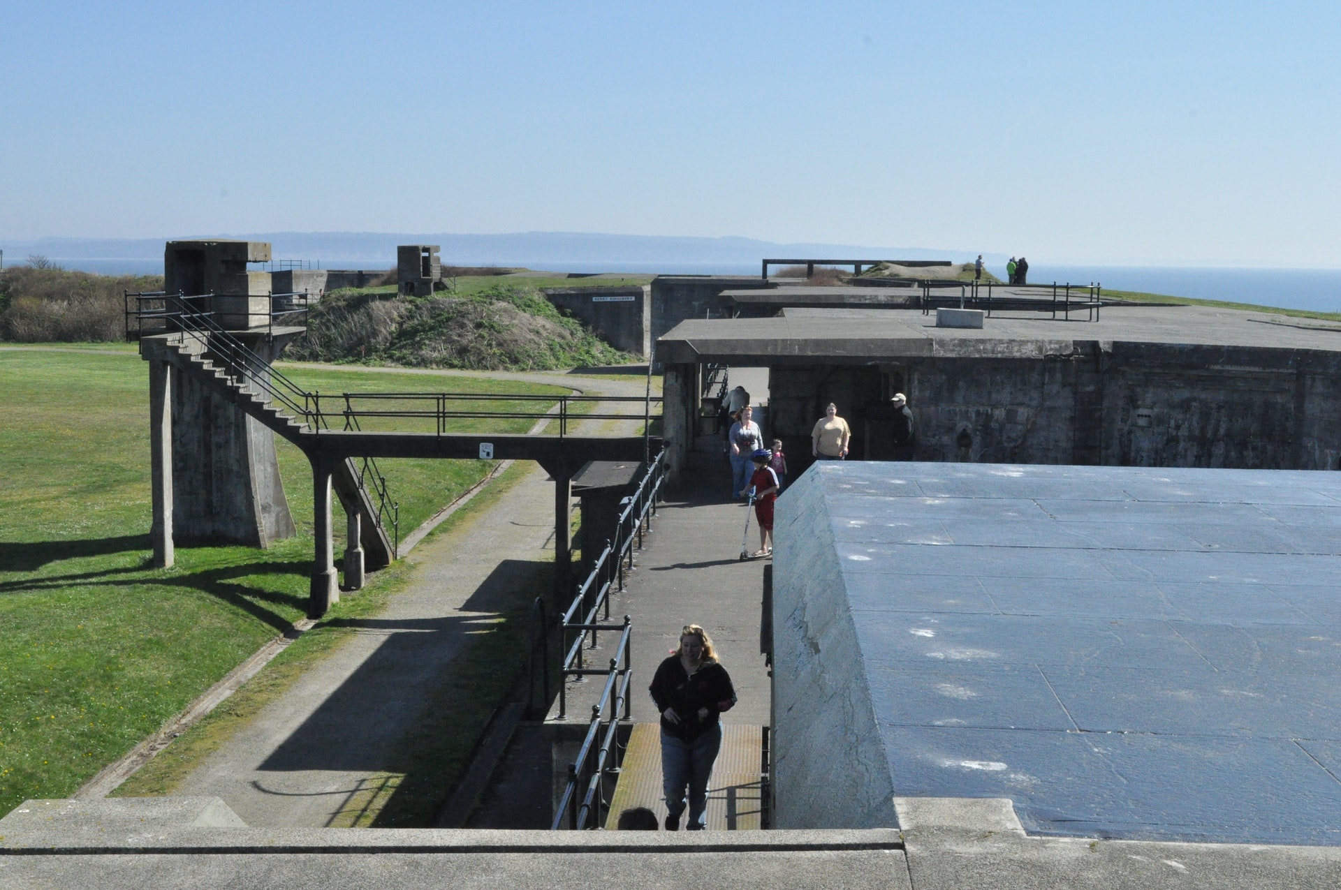
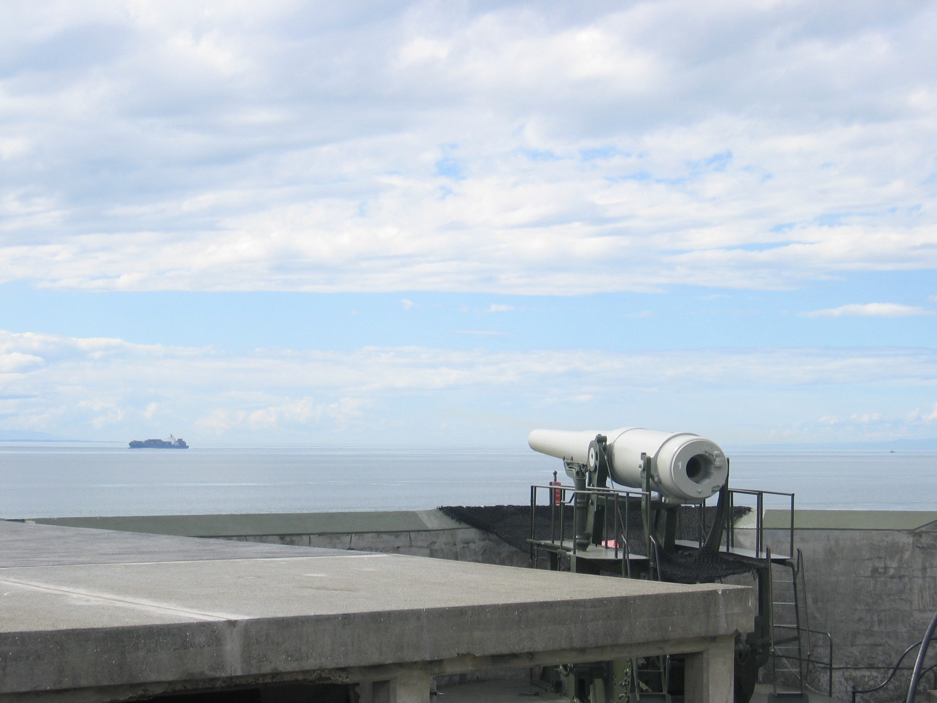
Fort Casey State Park is a 467-acre marine camping park with a lighthouse and sweeping views of Admiralty Inlet and the Strait of Juan de Fuca. A coast artillery post features two 10-inch and two 3-inch historic guns on display. The park features 10,810 feet of saltwater shoreline on Puget Sound Admiralty Inlet, and includes Keystone Spit, a two-mile-plus stretch of land separating Admiralty Inlet and Crocket Lake. The park is the site of Admiralty Head Lighthouse. A coast artillery post features four historic guns on display. The park offers spectacular views of Admiralty Inlet and the Strait of Juan de Fuca.
In 1858, the U.S. government purchased ten acres of land costing $400 for the construction of Admiralty Head Lighthouse. In 1890, the army took over the premises. It named its garrison "Fort Casey" in honor of Brigadier General Thomas Lincoln Casey, the last U.S. Army chief of engineers. At that time, Fort Casey, in union with Fort Worden and Fort Flagler, was said to comprise a "triangle of fire" guarding the entrance to Puget Sound.
When the fort was constructed, the old lighthouse had to be moved. A new lighthouse was built on the present site in 1903. Today the Admiralty Head Lighthouse at Fort Casey serves as a historic landmark and interpretive center. The park was incorporated into Ebey's Landing National Historic Reserve in 1980.
A Discover Pass is required for vehicle access to Washington state parks for day use. For more information about the Discover Pass and exemptions, please visit the
Discover Pass web page.
The park offers 35 standard tent sites, one restroom and one shower. Maximum site length is 40 feet (may have limited availability). Campsites are located next to the Keystone Ferry terminal. All are first-come, first-served.
More about park hours Check-in time is 2:30 p.m., and check-out time is 1 p.m.Quiet hours are from 10 p.m. to 6:30 a.m.Engine-driven electric generators may be operated only between the hours of 8 a.m. and 9 p.m.Length of stay: You may stay up to ten consecutive days in any one park during the summer; the stay limit is extended to 20 days between Oct. 1 and March 31.


 Share Your Fort Casey State Park Photos (click here)
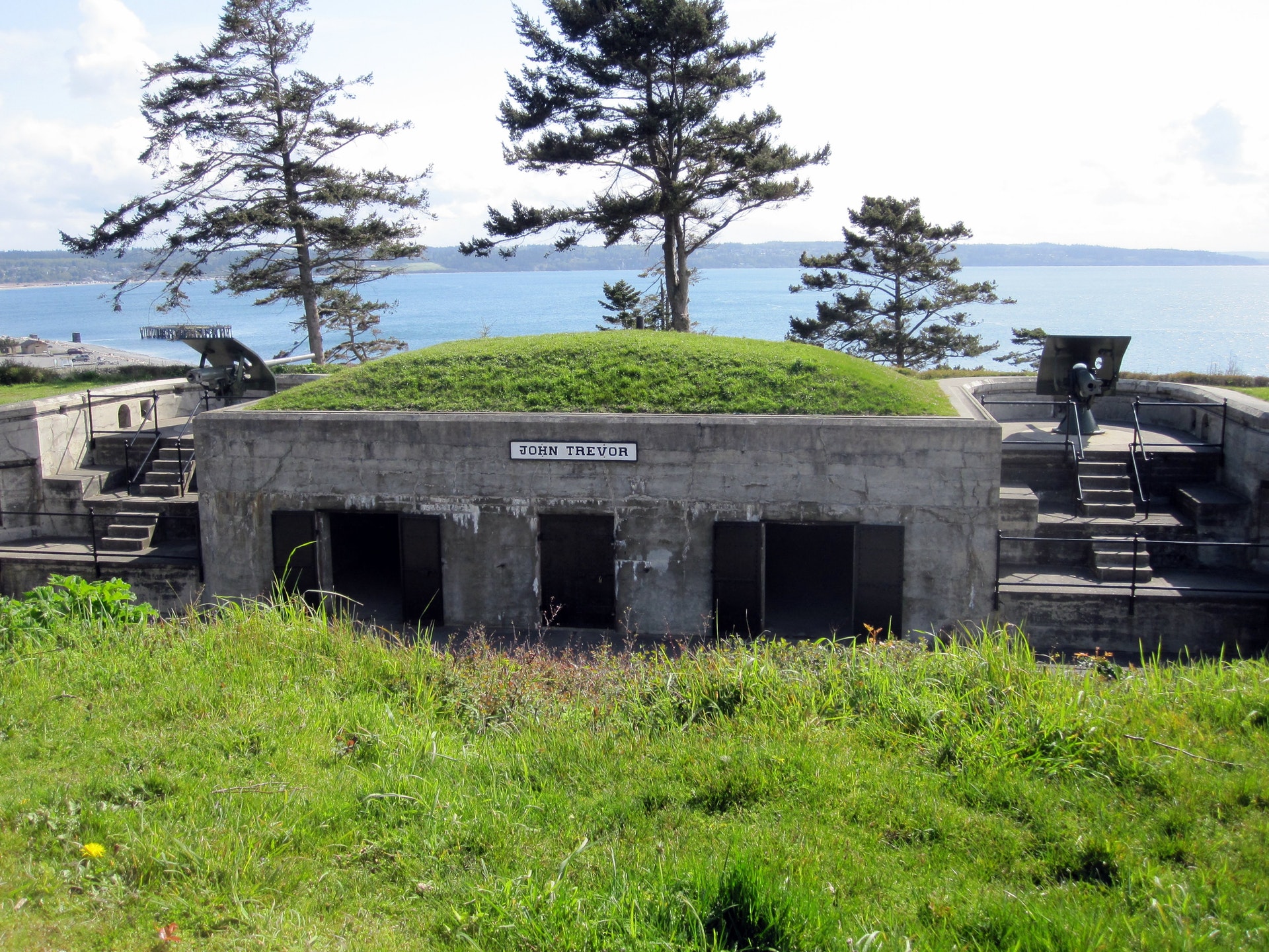