ENCHANTED ROCK STATE NATURAL AREA
Enchanted Rock State Natural Area sits on Big Sandy Creek on the border of Gillespie and Llano counties. It is 18 miles north of Fredericksburg.
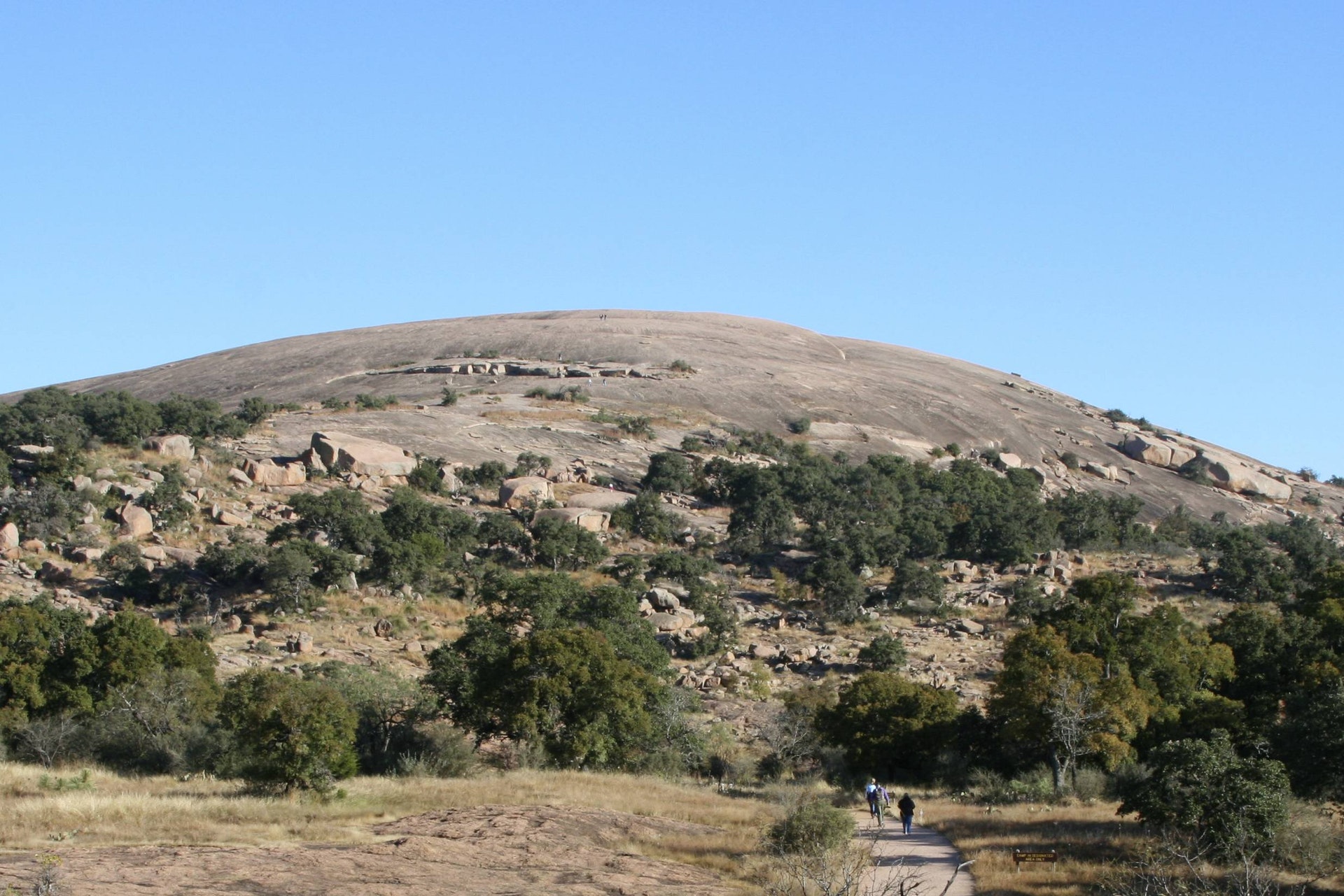
One billion years ago, this granite was part of a large pool of magma, or hot liquid rock, perhaps seven miles below the earths surface. It pushed up into the rock above in places, then cooled and hardened very slowly, turning into granite. Over time, the surface rock and soil wore away.
Those pushed-up areas are the domes you see in the park Enchanted Rock, Little Dome, Turkey Peak and others.
Although Enchanted Rock appears to be solid and durable, it continues to change and erode.
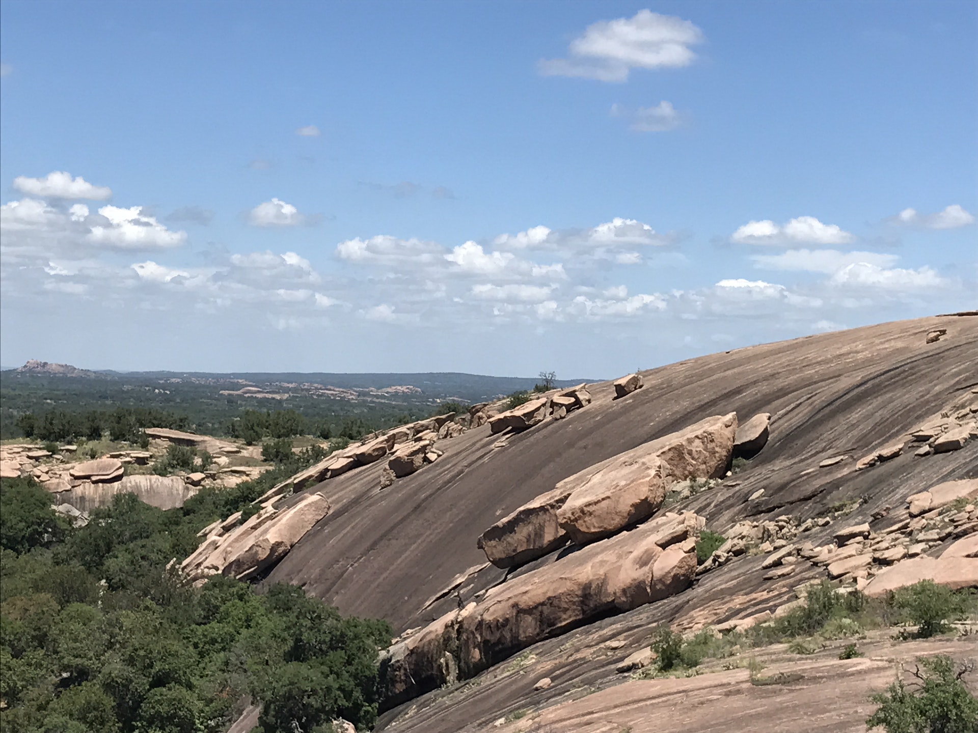
Enchanted Rock is an exfoliation dome as are the other domes here. That means it has layers like an onion.
After the rock and soil on top wore away, the granite expanded slightly because there was less weight bearing down on it. That expansion caused the dome to split into curved sections. As the outer layer of rock breaks into smaller pieces and slides off, the next layer begins to peel away from the dome. This is a process that continues today.
Enchanted Rock rises 425 feet above the base elevation of the park. Its high point is 1,825 feet above sea level, and the entire dome covers 640 acres. Climbing the Rock is like climbing the stairs of a 30- or 40-story building.
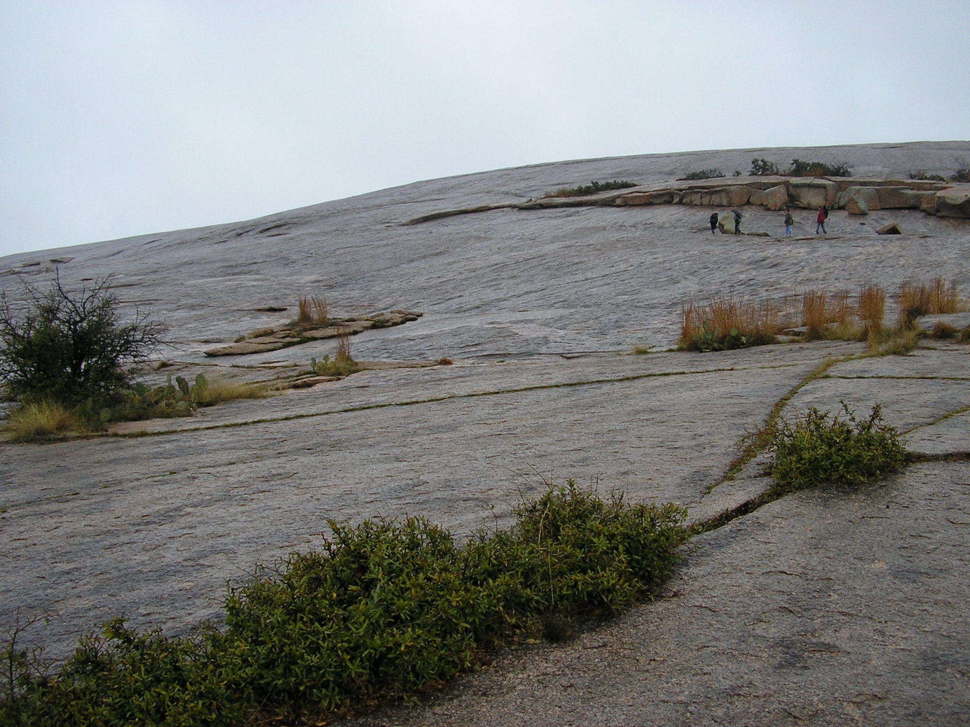
On more level portions of the dome, water collects in low spots, or weathering pits. The granite in these pits wears away faster than the surrounding granite. Pits that hold water for several weeks are called vernal pools. Over time, these pools develop into microhabitats, home to a unique group of plants and animals.
The pools are very fragile. Enjoy them from a distance. Protect this special habitat by keeping pets and people out. Tiny, translucent freshwater shrimp live in the vernal pools. These little fellows lay eggs which somehow survive the dry season. The eggs hatch when the pools refill with rainwater. The shrimp swim upside down, eating algae and plankton. In turn, they are eaten by birds, providing an important link in the food chain. These creatures are an integral part of the fragile vernal pool habitat.
The Nature Conservancy of Texas purchased the property from Charles Moss in 1978. It later sold the 1,640.5-acre property to the state of Texas. The state bought an additional three acres to add to the park.
Enchanted Rock opened as a state natural area in October 1978. It is a National Natural Landmark, and is on the National Register of Historic Places as an Archeological District.
More than 400 archeological sites have been found in the park. All are protected, and 120 of them are designated State Archeological Landmarks.
More than 250,000 people trek to the park each year to experience the magic of Enchanted Rock. In fact, it is one of the most visited parks in the state park system.
Humans have camped in this area for 12,000 years.
One enduring sign of their time here remains Prehistoric people ground or pounded their food on granite rocks throughout the park. They left depressions in the granite, called bedrock mortars.
The Spaniards first explored Central Texas in the 1700s. They mounted raids against the Lipan Apache and attempted to colonize this area. They established a mission and presidio on the San Saba River in the mid-1700s, and tried to establish a silver mine on Honey Creek near the Llano River.
Germans and Americans arrived by the mid-1800s, drawn by dreams of having land of their own and tales of gold and silver.
Enchanted Rock has fascinated humans for thousands of years. As a result, it has inspired many stories that endure today. Most of these are rooted in fancy rather than fact.
Tonkawa Indians thought that ghost fires flickered on top of the dome. The odd creaking and groaning coming from the dome frightened them. But dont worry Geologists say that the dome creaks and groans as temperatures change. As for the ghost fires, the rock glitters on clear nights after rain. Scientists think the glittering is reflections from collected water or wet feldspar.
One story tells of an Indian maiden who saw her tribe killed by an enemy. She threw herself off the top of Enchanted Rock, and her spirit haunts the rock still. Another romantic story tells of a young Spanish soldier who rescued his true love just as Comanches were about to burn her at the base of the rock.
Once, the Tonkawa captured a Spanish conquistador, who escaped by hiding in the rocks. This gave rise to an Indian legend of a pale man swallowed by a rock and reborn as one of their own. The Indians believed he wove enchantments on the area.


 Share Your Enchanted Rock State Natural Area Photos (click here)
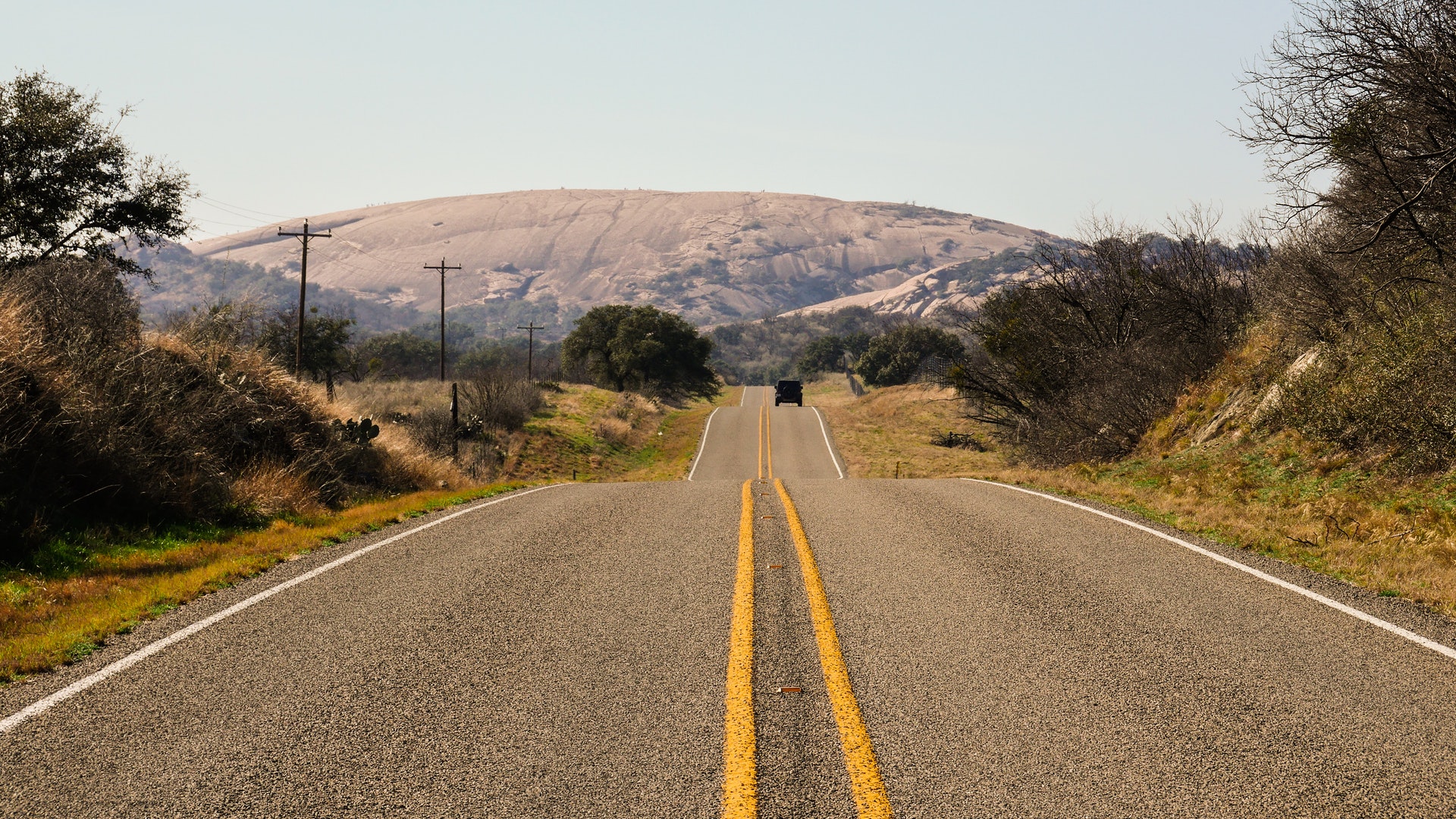