CAROLINA BEACH STATE PARK
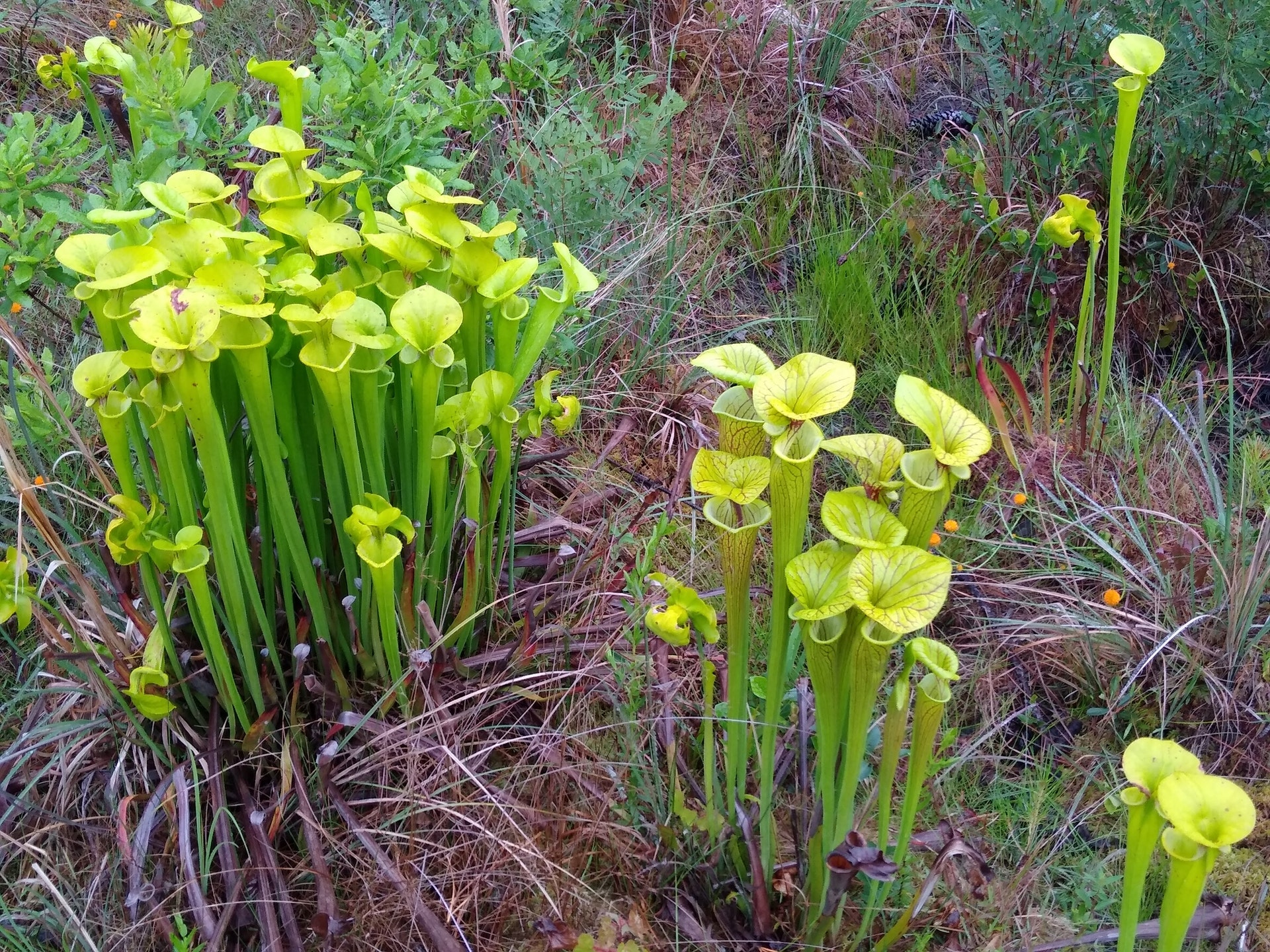
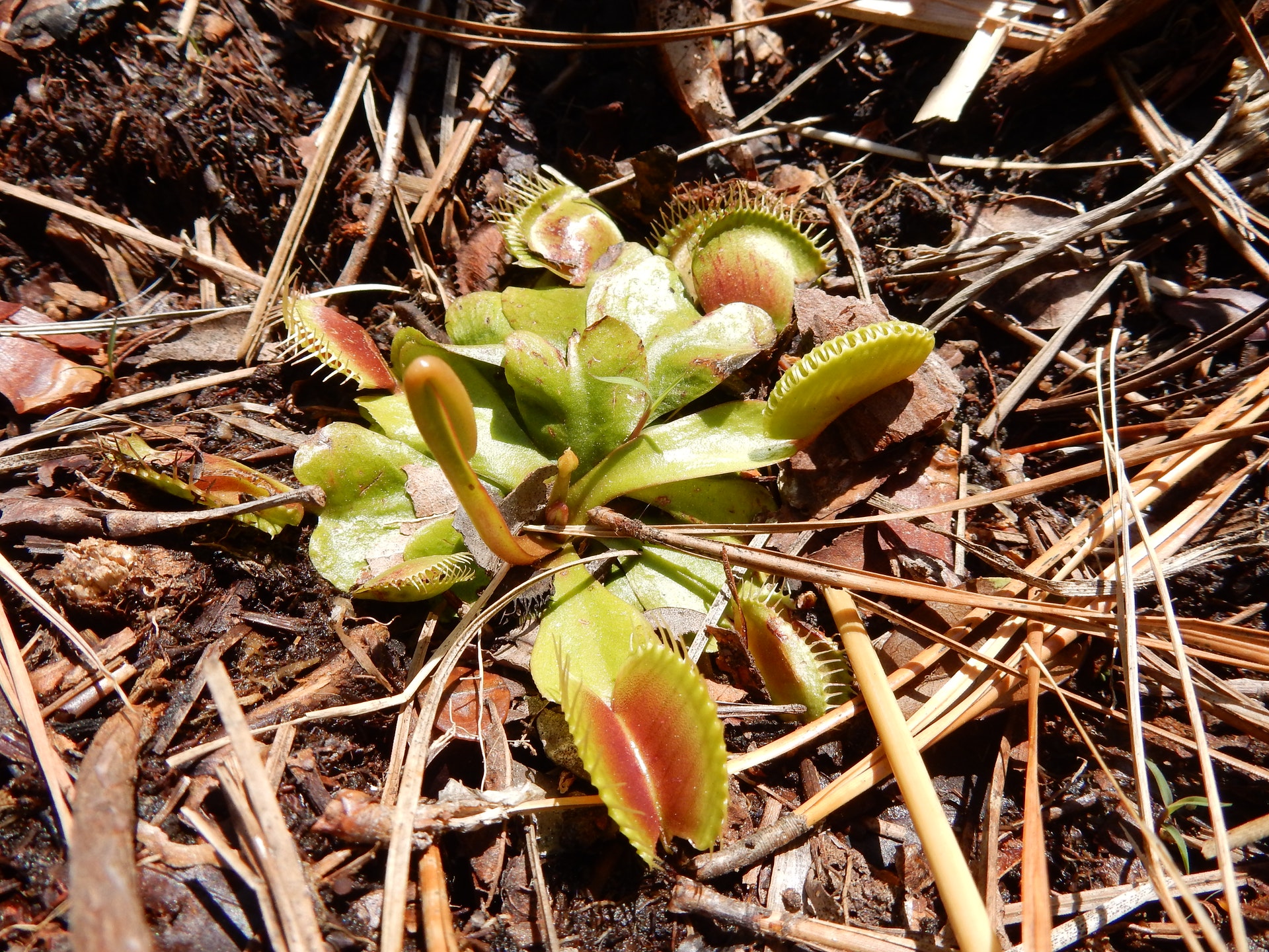
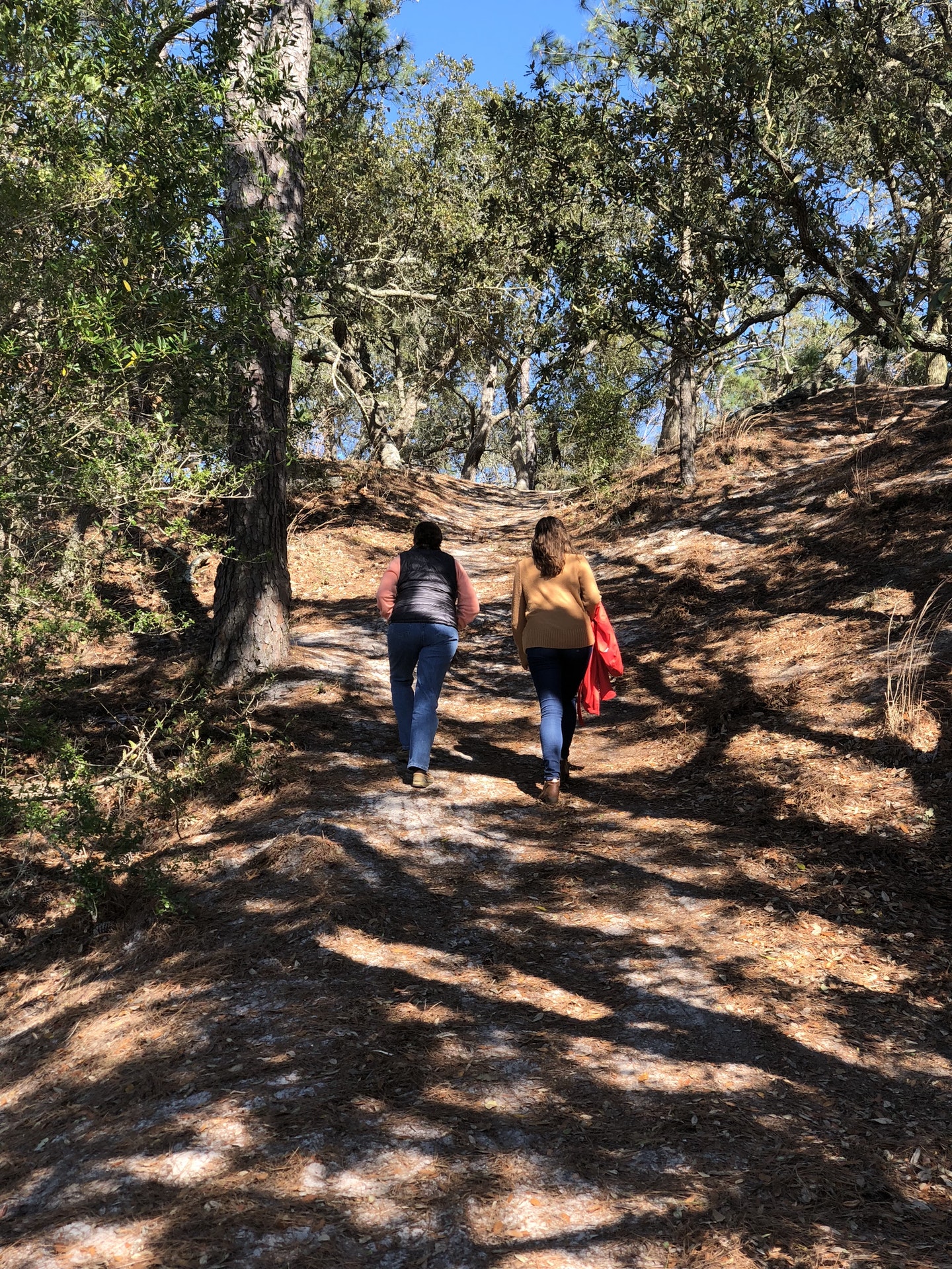
With a marina providing access to some of North Carolina's best fishing spots, a secluded camping area beneath towering trees, and miles of hiking trails that traverse a variety of distinct habitatsnot to mention the presence of the Venus flytrap, one of the world's most unique carnivorous plantsit's no wonder Carolina Beach State Park is a popular coastal attraction. Located in an area steeped in both history and natural diversity, the park includes a visitor's center with exhibits depicting the wonders of its environment.
Three limesink ponds, each vegetated by a unique plant community, are found in the park. Cypress Pond, the most unusual limesink pond in the park, is dominated by a dwarf cypress swamp forest. Lily Pond is occupied by the broad, oval leaves and beautiful, white flowers of water lilies, which cover its waters in early summer. Grass Pond, which dries out almost every year, is filled with a variety of aquatic sedges. Carnivorous plants thrive in the boggy soil around its edge and in the park's acidic, mineral-poor soil.
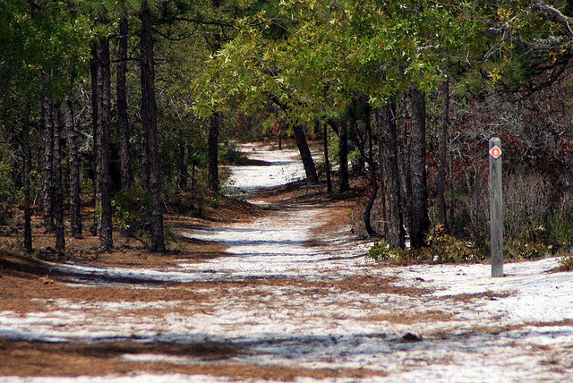
Several coastal ecosystems are present in the park. Forests dominated by longleaf pine, turkey oak and live oak occupy the dry, coarse soil of a series of relict sand dunes. Between the dunes are dense shrub swamps, called pocosins, populated by pond pines, loblolly and sweet bay, yaupon and evergreen shrubs. Brackish marshes consisting primarily of cordgrasses and sedges can be found beyond the relict dunes adjacent to the river.
Carolina Beach State Park is a great place for bird-watching. Brown pelicans thrive in the coastal environment, and warblers, finches and woodpeckers fill the woods. In summer, painted buntings, yellowthroats and prairie warblers can be seen in the forest, while ospreys populate Snow's Cut. In addition to providing habitat for resident land birds during the winter and summer, Carolina Beach State Park is located along an important migration corridor and attracts many birds during their migrations.
The Cape Fear Indians lived in and around the area that is now Carolina Beach State Park, prior to European settlement. Mainly occupying the land along the Cape Fear River and its tributaries, the small tribe grew hostile to early settlers and, in 1715, participated in an uprising against Europeans in the area. The Cape Fear Indians were defeated and left the area by 1725. Artifacts of the native culture, including pottery fragments, arrowheads and mounds of oyster shells, have been found in the area.
Sugarloaf, a 50-foot sand dune near the bank of the Cape Fear River, has been an important navigational marker for river pilots since 1663. The dune was also of strategic significance during the Civil War when, as part of the Confederacy's defense of the Port of Wilmington, about 5,000 troops camped on or near Sugarloaf during the siege of Fort Fisher.
Carolina Beach State Park was established in 1969 to preserve the unique environment along the intracoastal waterway.
The 761-acre park is located on a triangle of land known as Pleasure Island, which lies between the Atlantic Ocean and the Cape Fear River. The land became an island when Snow's Cut was dredged in 1929 and 1930, connecting Masonboro Sound to the Cape Fear River. Snow's Cut, a part of the Intracoastal Waterway, provides inland passage for boat traffic along the Atlantic coast.


 Share Your Carolina Beach State Park Photos (click here)
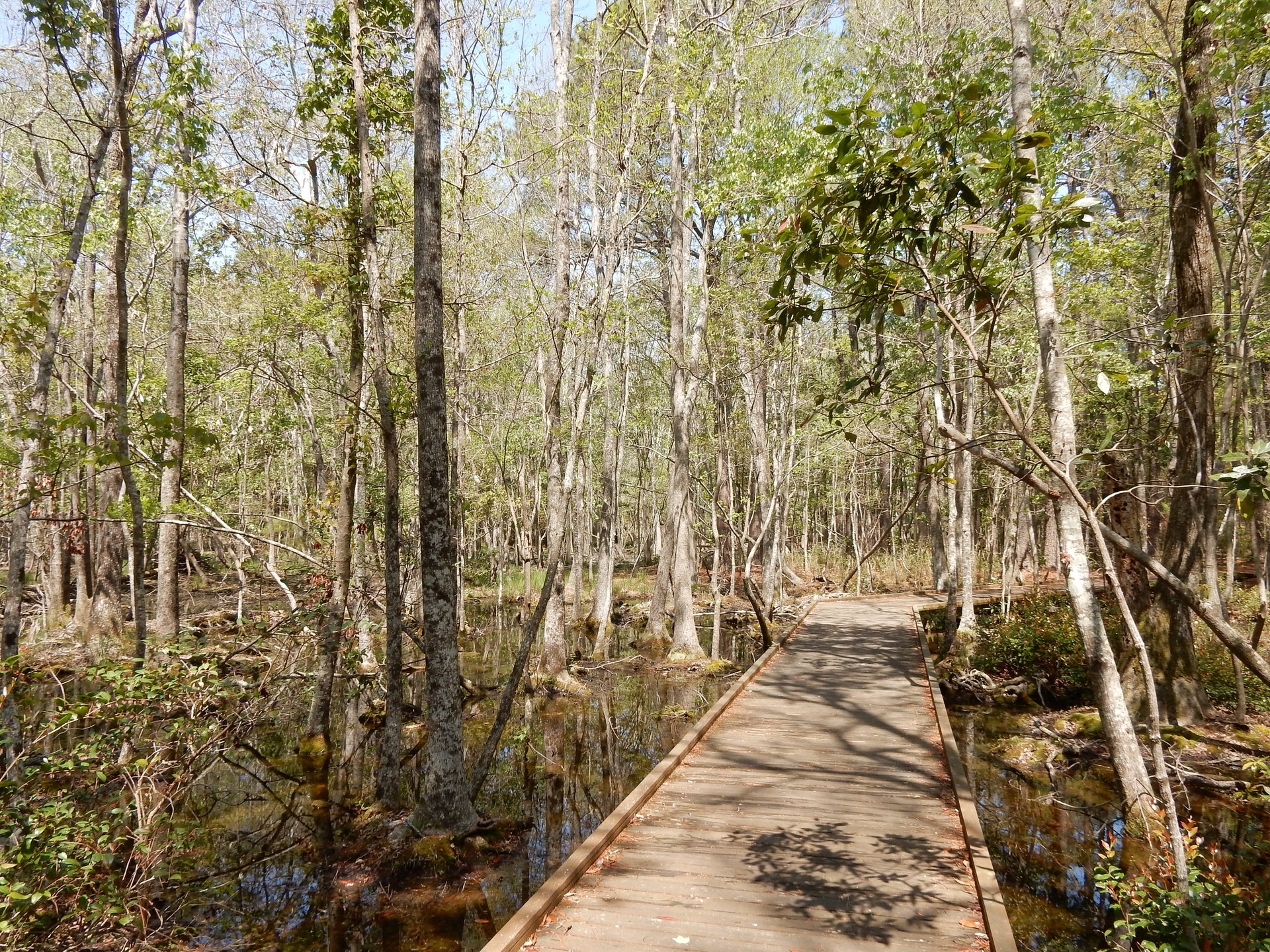